BENJAMIN FREIMAN
INTRO
At its most pure, the Metro-North Railroad is a twisting network of steel and wooden tendrils stretching ever northwards through the hills and boulders of southern New York State and Connecticut; a vital link between distal suburbs and exurbs and the densest and most populous place in the United States. However, the railroad’s use by commuters also represents a type of regional shibboleth, separating suburban and rural folk from the “real” New Yorkers who have no reason to travel outside of the five boroughs and into the amorphous unknown of “upstate”.
For these reasons and more, I have always been fascinated with the glaring contrast between the two poles of the Metro-North service area. Often the experience of riding the train to or from Manhattan is quite surreal. A passenger can board a train in one of the busiest sections of the busiest city in the country and within an hour or two be transported to a rural landscape of rolling hills, winding roads, glacial lakes, and dense hardwood forests. These outer stops represent the edges – physically, logistically, economically, and even culturally – of New York City’s reach into the northern regions of its metropolitan area.
In order to explore these distal stops both visually and critically, I chose the northernmost, westernmost, and easternmost nodes within the Metro-North system. These stations are Wassaic, NY, Port Jervis, NY, and New Haven, CT, respectively. I visited each of these stops over the course of three weekends in early spring 2022 to experience the contrasts inherent in a rail system that spans some of the most densely populated regions in the country, through suburbia, and into rural areas. I wanted to tour the region’s physical and cultural gradients from the perspective of a commuter and document where I landed in each direction. In particular, I paid close attention to two concepts in geography as I went through this exercise: distance decay and the coastline paradox. Distance decay refers to the waning influence of a place as one travels further from it. In this case, I was curious to track the influence of New York City on these faraway stations, and vice versa. The coastline paradox states that the measured length of a coastline increases as the method of measurement becomes more detailed and granular. This phenomenon is due to the fractal-like nature of a coastline and how it grows ever more complex the more closely it is observed. To me, the apparent similarities and differences between the stops seemed to become more intricate as I explored their idiosyncrasies.
PORT JERVIS STATION
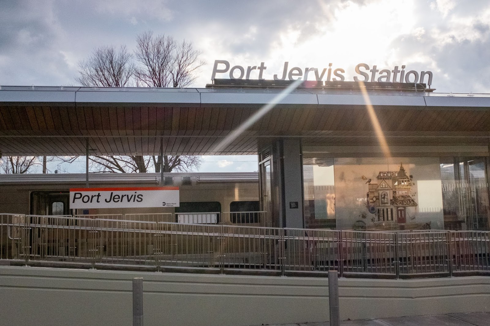
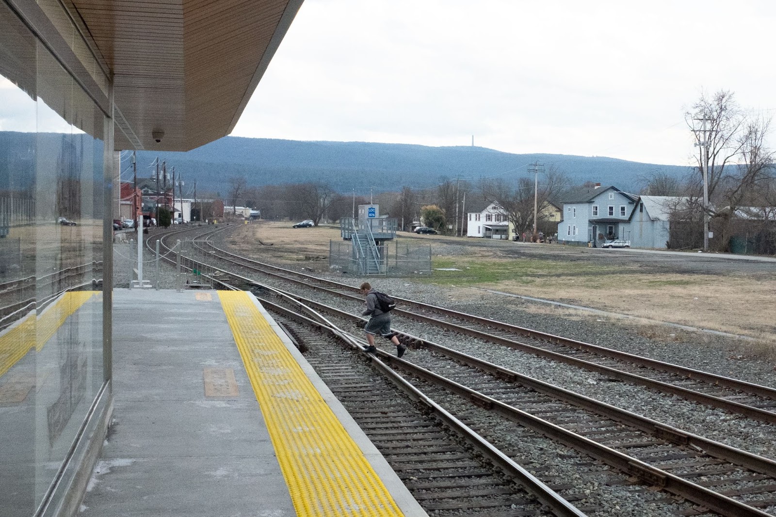
In many ways, Port Jervis is defined by its status as a crossroads. This Orange County city of 8,755 sits at the very crux of New York’s borders with New Jersey and Pennsylvania; the junction of I-84, US-6, and US-209; and the confluence of the Neversink and Delaware Rivers. Matamoras, Pennsylvania – a small community on the western side of the Delaware – is visible from the train station platform. While Wassaic’s balance of sleepy low density and Hudson Valley adventurism can appear as a logical conclusion of the urban-rural continuum that begins at the heart of Manhattan’s conglomeration of concrete, steel, and imperceivable ancient bedrock, Port Jervis seems shielded from New York’s sphere of influence (at least on the surface). Port Jervis felt like the gateway to a completely different region, divorced from the tense, inseparable dance between New York City and the suburbs and farms of the Hudson Valley.
I spoke to two travelers while loitering with my camera at the Port Jervis station. Lia, a mother of two originally from the Bronx who now lives in bordering Pike County, PA, noted that while she enjoys her current lifestyle, she is frustrated by the four- to six-hour journey to see her family in Woodlawn. This trip involves taking the train from Port Jervis to Secaucus Junction to New York-Penn Station to Grand Central, where she finally boards the 4 and rides it uptown to its final stop in Woodlawn. Benoit, a recently retired executive event planner who moved from Manhattan to Pike County with his husband around fifteen years ago, said that while his journey to Manhattan was often long, he enjoyed the ride and appreciated his home life in semi-rural Pennsylvania.
Benoit also commented on the “gentrifying” state of Port Jervis. He told me that businesses such as yoga studios, vintage shops, and vegan restaurants are moving into the area and that he thinks Port Jervis is a great destination for city folk to put down roots. What changes these new businesses will bring to the social and economic fabric of Port Jervis is still to be seen.
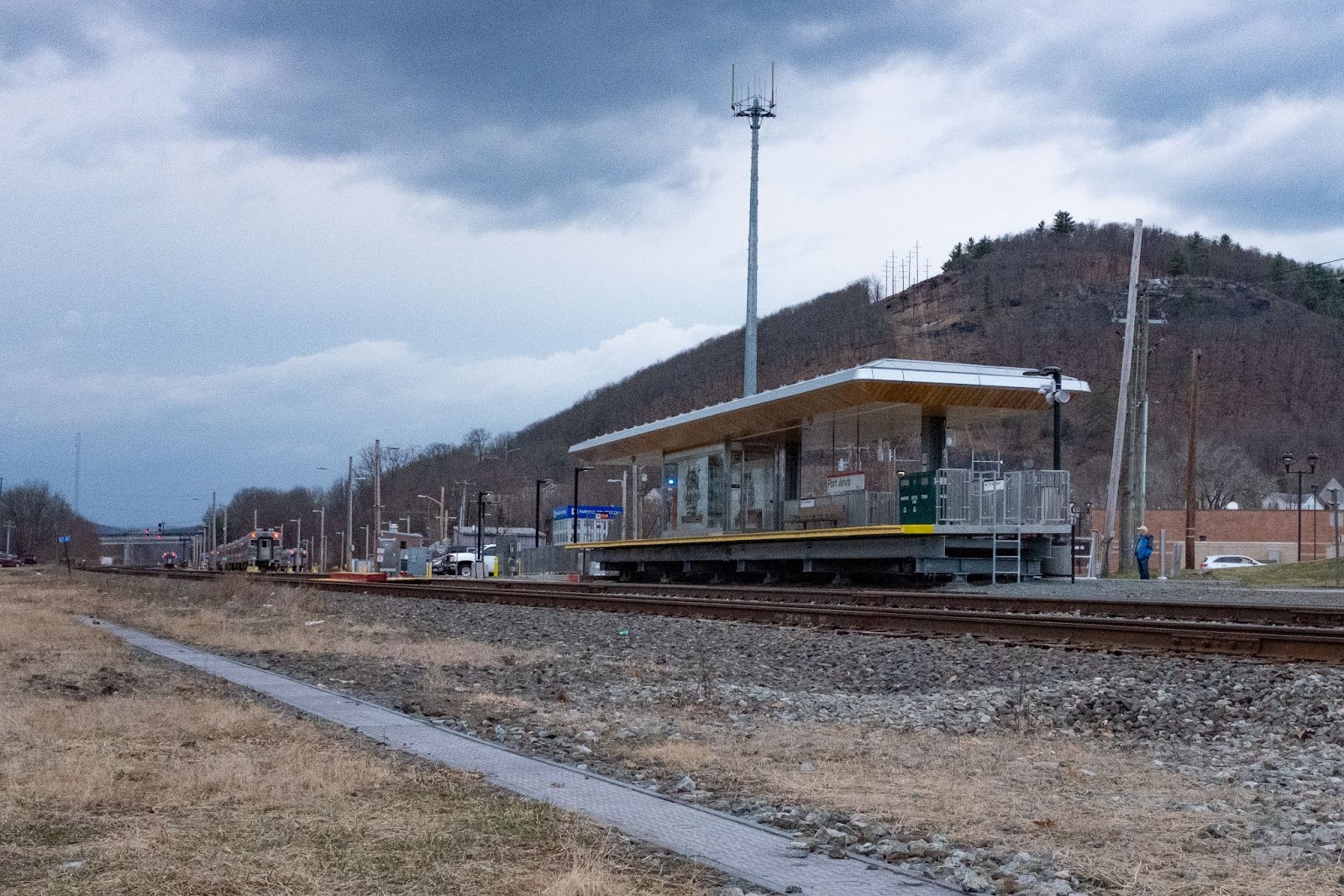
The Port Jervis station is sandwiched between the railroad right-of-way, a Burger King drive-thru lane in a strip mall parking lot, and a dramatic scenic hill that marks the beginning of a natural recreation area. This juxtaposition is frankly comical, as it illustrates the complicated ebb and flow of capital, infrastructural ideology, and local priorities within the region.
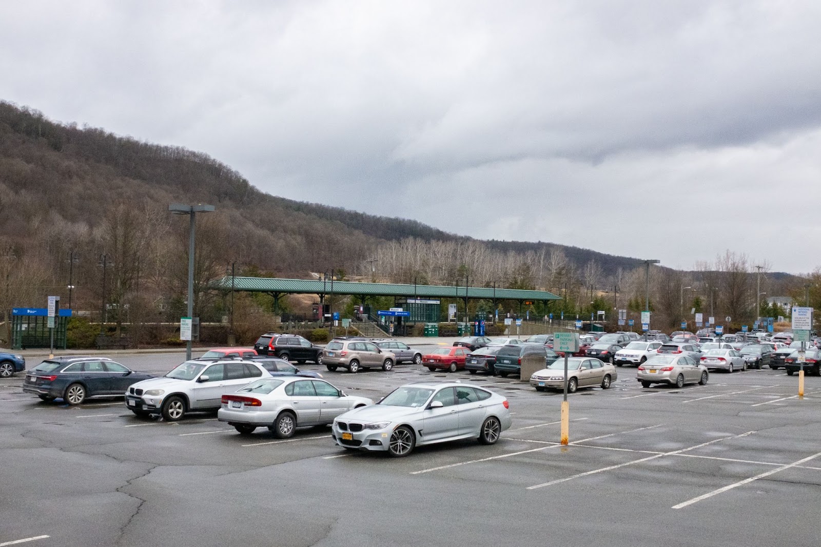
WASSAIC STATION
To me, the Metro-North station at Wassaic feels like a true “end of the line.” A smear of blacktop, streetlights, and MTA iconography nestled in a valley of the dramatic Taconic Mountains, Wassaic feels very far away from the glowing glass cliffs of Midtown Manhattan. A typical commute to Midtown Manhattan takes two to three hours; no matter how you cut it, commuting to and from Wassaic is a long journey. The station as it exists today is not the original site of the area’s rail hub. The original station was located one mile south in the hamlet of Wassaic but moved to its current location in the early 2000s as Metro-North extended its Harlem Line service northwards to former railroad communities in the Hudson Valley.
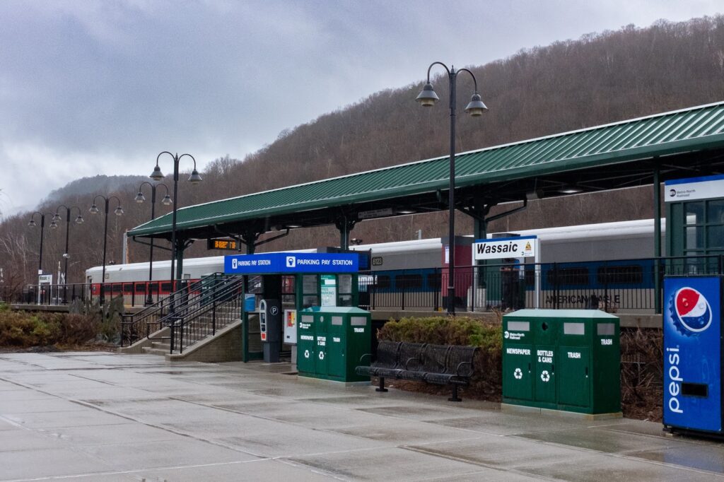
The hamlet of Wassaic (population 1,200) was a visually and topographically interesting place when I visited on a drizzly early-spring day. While the rail station was abuzz with activity in the half-hour prior to the arrival of a Manhattan-bound train, the hamlet itself was a sleepy collection of proud – if not aged – buildings that recalled a more industrious time in the region’s history. In addition to a commuter rail station, Wassaic is also the starting point of the Harlem Valley Rail Trail that runs along the original right-of-way established by rail companies in the 19th century. Currently, 26 of the proposed 46 miles of trailway are paved.
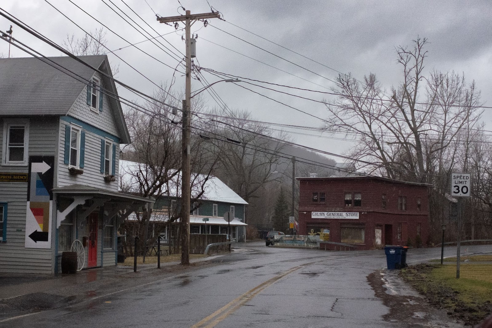
While leaving the station, I briefly spoke with Joe and Teddy, a young couple from western Connecticut, as they were packing their bikes into their truck following an excursion along the trail. The couple said that they come to Wassaic station a few times a year to enjoy the scenic mountains and hills along the paved path. The two had never taken the train from the station and usually drive to a Metro-North station elsewhere in Connecticut when they need to travel to Manhattan.
NEW HAVEN
Compared to the other termini of Metro-North, New Haven is a “city” city. New Haven proper boasts a population of around 134,000 and holds the rank of second most-populous city in Connecticut and seventh in New England overall. While it may be much smaller than New York City, New Haven is undeniably an established urban center with vast economic, cultural, and geographic importance.
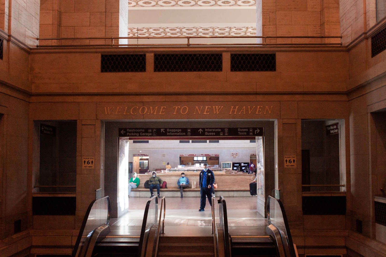
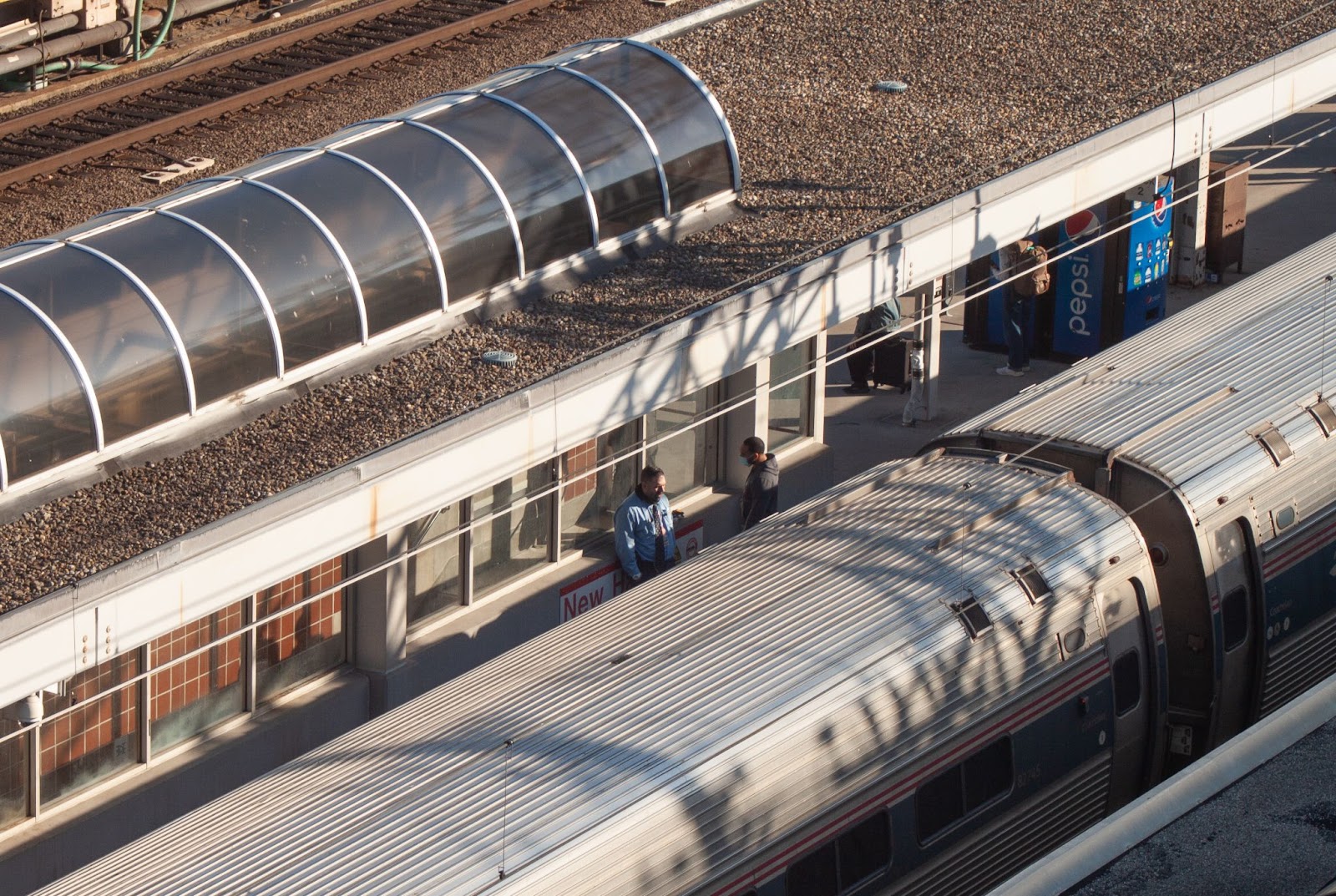
Appropriately so, New Haven’s Union Station is an austere yet grandiose train facility; the building’s beaux-art flair and brick and stone interior recalls a bygone era of early 20th century rail dominance. With nine tracks, Union Station is by far the busiest and most active station of the three I visited.
Union Station currently serves three different railway operators: Metro-North, CT Rail, and Amtrak. During my time at the station, I saw rolling stock from all three operators either depart or arrive at the station. The complexity of Union Station passengers’ destinations interested me. Were they headed to New York City? To Massachusetts? To the West Coast? Union Station’s most obvious characteristic is its status as a unique intersection of Northeastern transportation networks. An MTA worker I spoke to said that Metro-North riders take up the majority of passengers he sees on an everyday basis. While anecdotal, this remark highlights the stark dominance of the New York City metro area over the economy and culture of southwestern New England and the entire Northeast US region.
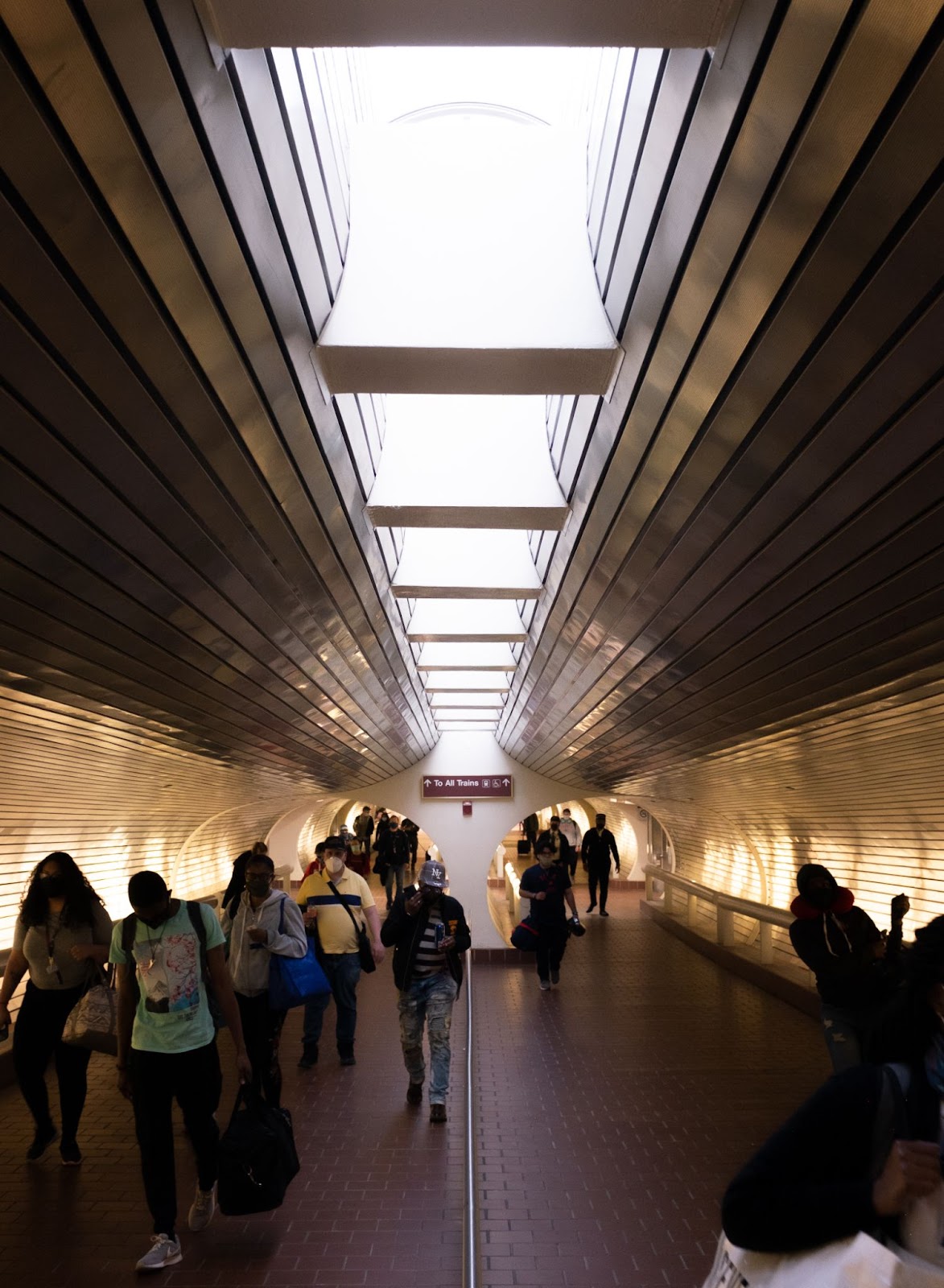
To access the station’s platforms, one must walk through sleek retro-futurist tunnels lined with brushed steel. As I pushed against the current of passengers, I was struck by how different Union Station felt from any of New York’s major train hubs.
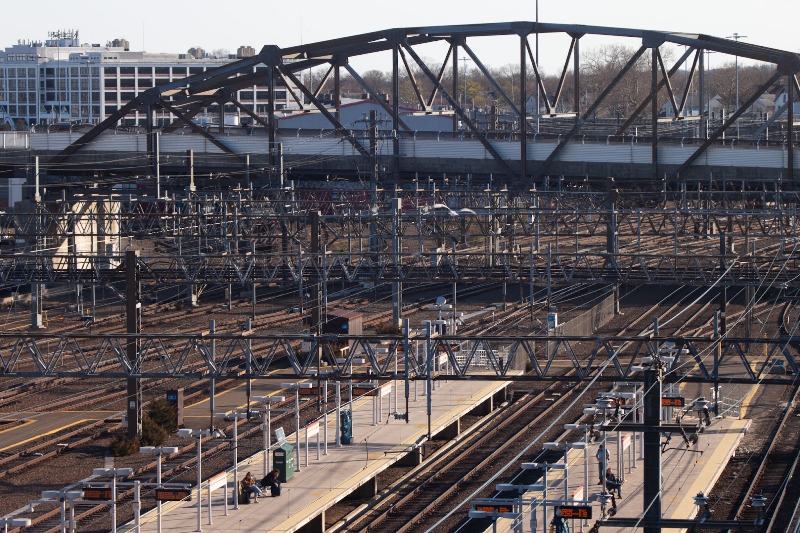
Unabashedly urban yet effortlessly not New York City, Union Station stands on its own as a bustling and historic transit hub in one of New England’s most populous cities. Later, as I stood atop the station’s massive parking garage and observed the twisting braids of wires and steel below me I considered how far I felt from New York City. Despite the urban surrounds and throngs of busy riders, Union Station felt as separated from Manhattan as any of the previous stations I visited.
CONCLUDING THOUGHTS
As I reflect on my journeys, I find an expansive relationship between distance decay and the coastline paradox. Distance decay, while hard to measure, plays a major role in the interactions between the core of Metro-North (Manhattan) and its most outlying stops. The environment, people, and culture around a Metro-North station like New Rochelle or Stamford, for example, may still appear somewhat “New York-y.” However, these similarities grow fewer and less prominent the further one gets from Grand Central Terminal. This phenomenon is obvious at all three stations, yet the “decay” manifests itself in unique ways.
Furthermore, the coastline paradox becomes relevant when examining this decay. A clumsily macro-level perspective would claim that Port Jervis and Wasasic, for example, are sleepy “upstate” dots on a map surrounded by hills and trees. Similarly, one can simply write off New Haven as an extension of the Northeastern megalopolis; a smear of slightly higher-density urban form among the sprawl of Connecticut’s southern coast. However, the differences between Wassaic, Port Jervis, and New Haven grow increasingly more apparent the more closely we examine them in the context of their place within the Metro-North system. My journey to Metro-North’s ends of the line sparked curiosity, intrigue, and a desire to explore deeper. These stations are not simply disconnected pins on a map. They are strategic end points of the nation’s third-busiest commuter rail network serving the world’s largest urban area, and they remind us that no city exists in isolation.
Ben Freiman is an MUP student, transportation planner, artist, and musician based in the Lower Hudson Valley. His professional work centers on transit accessibility, equitable urban spaces, and design. Ben’s creative and academic endeavors often focus on sense of place, spatial idiosyncrasy, and novel technologies. Find him on Instagram: @benf.images.